Using Bluetooth to improve traffic

Aarhus, the second-largest city in Denmark, has been using BlipTrack Bluetooth sensors for several years to collect traffic information based on the movement of road users´ Bluetooth devices.
The sensors – placed on the entire road network, including adjacent highways – provide the city with both real-time and historic traffic information including driving times, speed, dwell times and flow.
Aarhus has around 230 intersections regulated by traffic lights. If just one of these traffic signal installations is not working optimally, or breaks down, it directly affects traffic flow in a large surrounding area.
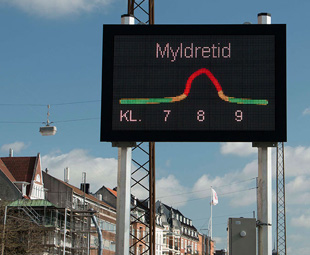
Besides the benefits of real-time reporting – which enable the city to gain in-depth insight and understanding of current road density, flow and formation of queues, as well as to share traffic information with road users on signs – the historical data is now being used to detect driving time anomalies.
Effectively, this means that the city can pinpoint road sections and intersections where driving times deviate from the norm as a result of construction projects, incidents, roadworks, faulty traffic lights and other factors.
“The benefits we have gained from the solution since implementation are very significant. We now discover errors and irregularities that we would otherwise not have a chance to see. In addition, it is easily accessible and extremely educational to study how the incidents of various kinds influence the road network,” says Asbjørn Halskov-Sørensen, ITS project manager at Aarhus Municipality.
The solution provides an objective, measurable expression of the driving experience of road users, as the Bluetooth sensors measure both short and long distances, the turn flow through intersections and groups of traffic lights in the road network. Now, issues are detected and the city is able to ensure that traffic lights are working correctly and programmed optimally.
“Ultimately, the data contributes to an improved economy and a better environment through reduced driving times and fuel consumption, and thus reductions in greenhouse gas emissions from vehicles,” says Halskov-Sørensen
Since the city has full access to all the raw data, the plan is to combine the solution with existing surveillance systems.
Published by
Focus on Transport
focusmagsa


