Mapping and the marketplace
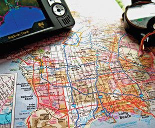
While the basic map has long been surpassed by satellites and global positioning systems, the principle of knowing where you’re going and what to expect remains the same – only now it’s been taken to a whole other level.
When Roger Tomlinson, the so-called father of the modern Geographic Information System (GIS), was asked what it felt like to have sparked such a powerful movement, he said: “Well, the early days of GIS were very lonely. No-one knew what it meant.” One could argue that not much has changed since the 1960s, as few have fully explored what spatial data could mean for their businesses.
“Spatial data is anything that can be put on a map,” Mike Steyn of GIS consultancy Aspire Solutions explains. “It is has evolved beyond the basics of weather, traffic information and vehicle tracking and become more sophisticated, leading to new solutions to many of the common business problems that exist today.”
The transport industry, in particular, has benefited from the implementation of GIS technology, which instantly provides a visual context of their operating environment – the location, the orientation, distance and area. “It could be used to answer important questions in the planning phase, for example, where are the new customers, where are our competitors based, what will the cost of doing business be in the area?” says Steyn. “It can also allow existing businesses to review the efficiency of the supply chain, or to geolocate potential risks presented by natural or man-made perils en route.”
Major cities are already using such systems to reduce problems such as accidents and congestion. The New York Department of Motor Vehicles successfully used spatial data to pinpoint frequent accident locations, and was then able to tackle the problem area by placing additional traffic officers and signage on the “high-risk” roads. The city of Cape Town is using a system called TRS to integrate information from surveys of public transport used to optimise efficiency and give city planners an overview of public transport patterns on a single screen, whereas major logistics companies are using the data to reduce the number of trucks on the road while making more trips per hour.
As Jack Dangermond, who made history by using spatial data for landscape architecture and environmental data, once put it: “The application of GIS is limited only by the imagination of those who use it.”
Modern GIS systems will also reduce insurance and maintenance costs for the logistics industry as trucks can literally avoid danger zones such as potholed roads, fog, obstacles and storms.
“But for companies that focus on transportation or rely on efficient logistics, the biggest value lies in streamlining operations,” says Steyn. “Petrol prices are steep and are not going to decrease anytime soon. Companies are literally burning money by letting vehicles sit idling in traffic. GIS systems can provide real-time updates about road and traffic conditions, allowing transport departments to plan alternative routes.”
Businesses using a spatial data strategy will find that they have a new measure of control over their vehicles, gaining insight into where they are, what obstacles can get in their way, and what resources are at their disposal to overcome aforementioned difficulties.
“At our core, we’re visual thinkers,” Steyn concludes. “When we have a visual presentation of our surroundings, it becomes easier for us to spot patterns and trends. Spatial thinking is a powerful way to solve the disconnect between data collection and business intelligence.”
Published by


focusmagsa


